The Welland Canal And The Metal Beasts That Travel
It

The Welland Canal:
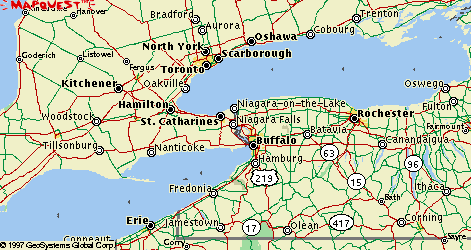
This is map of the surrounding area of the Canal
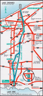
This is a detailed map of the Welland Canal
The Bluenose II On The Welland Canal

The Welland Dry docks
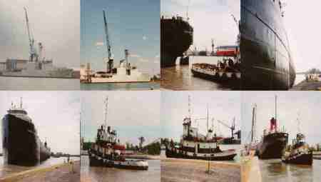
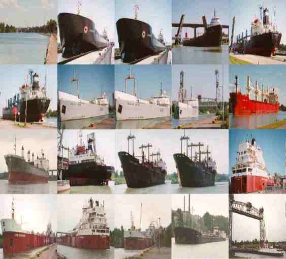
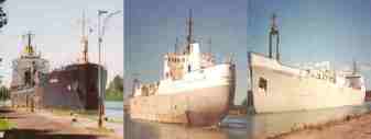
Other Ships on the Welland Canal
Information:
The Welland Canal was built to circumvent, Niagara
Falls and toconnect Lake Ontario to Lake Erie. It provides a man
made deep waterwaysystem for lakers and ocean vessels to navigate
into the heart of the continent.The first Welland Canal opened
in 1829.
The present canal officially opened August 6, 1932
when the GovernorGeneral of Canada, the Rt. Hon. Earl of Bessborough
turned a lever releasingthe guard fender at the upper end of the
flight locks.
Each of the seven locks has an average lift of 14.2m(46.5ft.)
Locksone to seven are lift docks. Lock eight is a regulating lock,
the liftvarying from .3 to 1.2m (1 to 4ft) making the final adjustment
to lakeErie's level. Locks 4, 5 and 6 are called the "flight
locks" because nocanal reach separates them and they are
twinned to allow two way traffic.
The average transit time of the 42 km (26 mile) Welland
Canal iaabout 11 hours.
The difference in elevation level between Lake Ontario
and LakeErie is 99.5m (326.5ft).
All locks on the St. Lawrence Seaway System are filled
or emptiedby gravity. To raise a vessel, the upstream valves are
opened at the bottomof the walls. When a vessel is to be raised
the following procedure isused:
1. The ship sails through open gates into the lock.
It then issecured to bollards near the side of the walls.
2. The gates are closed and when the valves are opened
to allowthe water to flow in the ship begins to lift.
3. When the ship reaches the correct level the gates
are openedand the ship can sail out.
When a vessel has to be lowered, the procedure is
reversed. Ittakes approximately ten minutes and and an average
of 94.5 million liters(21 million imperial gallons) to fill a
lock.
A lock is 261.8 m (859 ft) long and has a width of
24.4m (80 ft).Ships, however, cannot exceed 222.5 m (730ft) long
and 23 m (75.5 ft) widein order to transit the canal.
Most significant improvement to the Welland Canal
was the constructionof a new channel to replace the old canal
which bisected the City of Welland.The realigned canal opened
to navigation, March28, 1973. This by-pass eliminatesdelays to
ships navigate, road and rail traffic.
The Port Robinson bridge (NO.12) was destroyed when
struck by theM\V STEELTON, Augest25 1974.
Grain, iron ore and coal constitute three of the most
significantcargoes carried through the canal.
As the canal operates 24 hours a day, variable intensity
lightinghas been built along the whole length.
The number of ocean going vessels through the canal
was 900 in1996. The number of transits made by lakers was 2,400
in 1996. The cargotonnage transported through the canal in 1996
was 41,100,000 metric tones(45,292,200 short tons).
There are 11 railway and roadway bridges crossing
the canal. Roadwayvertical lift bridges, with a clearance above
the water of 36.6m (120 ft),are located at Glendale Ave. St. Chathrines;
Highway No.20 Allanbburg;and Clarence Street Port colburne. Railway
lift bridges are located inThorald South and Port Colburne.
The Welland Canal's minimum depth is 8.2m. (27ft).
This page was created by Mike
Cramp